I talked the other day about weird maps, focusing primarily on literary examples of them. Today, I want to draw attention to the maps of Trollworld, the setting of Ken St. Andre's Tunnels & Trolls.
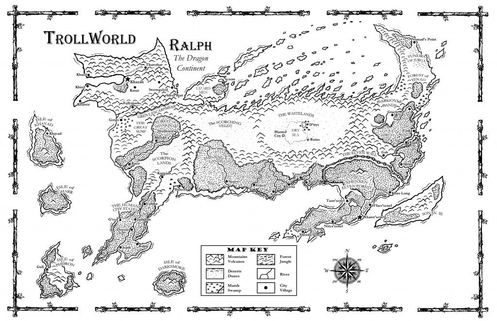
This is the continent of Ralph (or Rrr'lff, as it is known in some later sources). As you can see, it's shaped like a dragon, just like the one depicted in the Chart of Weirdworld. If anything, though Ralph is even more fantastical, since it looks like the entire body of a dragon rather than just its head. Ralph is home to Khazan, perhaps the best known city of Trollworld.
Zorr is the eagle-shaped continent of Trollworld. It's also the land of the letter "z," as nearly all of its locations include that letter somewhere in their names. If I recall correctly – and my knowledge of
T&T lore is limited – Trollish names tend to include lots of z's in them. Of course, that's a minor detail in my estimation compared to the appearance of the continent itself. Trollworld isn't a natural place; there is nary a concern for plate tectonics, geology, or anything remotely scientific. Instead, I suspect that Zorr, like Ralph, looks that way, because someone thought it was cool – and that's a perfectly valid reason in a fantasy roleplaying game setting!
Allow me to lay my cards on the table: in my own efforts to create fantasy settings, I have tended toward the Middle-earth/Hyboria model when it comes to map making. I don't outright eschew magical weirdness and whimsy but neither do I embrace it the way that Trollworld clearly does. Is that a mistake? No, I don't think it is – not all fantasy settings are the same and there is room for a variety of different approaches. At the same time, I can't help but look at maps like that of Weirdworld or Trollworld and wonder. Isn't that what maps of fantasy worlds should make us do?


No comments:
Post a Comment